Montana State Hand Drawn Outline Map USA: Bridging Geography, Design, and Creativity
Maps have always held a quiet power. They anchor us to a sense of place, tell stories of boundaries and belonging, and guide the eye across landscapes we may never physically tread. In the modern digital workspace, the humble outline map has evolved into something far more dynamic than a simple reference image. The Montana State Hand Drawn Outline Map USA is a prime example—a meticulously crafted digital asset that merges the organic charm of hand-drawn illustration with the precision required for professional design, education, and fabrication. Whether you are a graphic designer seeking a clean Montana map for a branding project, a teacher building an educational Montana map for a classroom, or a small business owner operating a laser cutter, this versatile file collection opens up a world of creative possibilities.
What Exactly Is a Hand-Drawn Outline Map?
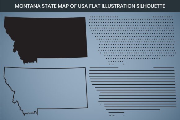
At its core, an outline map strips away topographical detail, road networks, and urban clutter to leave only the essential silhouette—the pure, unadorned shape of a territory. The hand-drawn element introduces subtle, organic line quality that feels warmer and more human than strictly geometric vector paths. When you look at the Montana state outline in this collection, you notice the gentle undulations of its borders, from the straight-line precision of its eastern boundary to the rugged, mountainous contours that hug the Continental Divide on the west. This is not a cold, clinical shape. It carries the texture of an artist’s hand, making it ideal for projects that need to feel authentic, approachable, and thoughtfully crafted.
Unpacking the Technical Specifications
Understanding the technical backbone of a digital map file is essential before you invest time or money into a design project. The Montana State Hand Drawn Outline Map USA is engineered to meet professional standards across print, web, and CNC workflows. Let’s break down exactly what you receive and why those numbers matter for real-world output.
High-Resolution Dimensions and Clarity
The map is delivered at 3000 x 2000 pixel dimensions with a 300 DPI (dots per inch) resolution. Why is this pairing significant? A 3000-pixel-wide image at 300 DPI translates to a crisp 10-inch-wide print without any upscaling. If you need a larger poster, you can scale further with confidence because the underlying vector formats eliminate pixelation entirely. The RGB color mode ensures vibrant on-screen display, whether you are embedding the map into a website, an infographic map dashboard, or a digital presentation. For offset printing, a quick switch to CMYK can be accomplished directly in any editing software that opens the native AI or EPS files.
Laser Cut Design Compatibility
One standout feature is the laser cut design readiness. The shape is prepared with clean, continuous paths that laser engraving and cutting machines interpret correctly. This means you can turn a digital Montana silhouette into a tangible wooden sign, acrylic keychain, leather patch, or metal art piece without hours of node cleanup. The DXF file format, which originates from AutoCAD and is the lingua franca of CNC machinery, is included specifically for this purpose. Makers and small-batch manufacturers will appreciate how the design preserves the integrity of Montana state boundaries at any scale, from delicate jewelry to large wall installations.
Complete File Format Breakdown
A single map sold in one file format can be frustrating. You might find yourself trapped, converting files and losing quality along the way. This product bundle solves that problem by including every major format a project could demand. Here is the full list and why each format matters:
- AI (Adobe Illustrator): The native, fully editable file for professional designers. Layers, strokes, and fills are maintained for deep customization.
- SVG (Scalable Vector Graphics): Ideal for web development, responsive design, and use in HTML5 applications. SVG files render crisply on any screen size.
- EPS (Encapsulated PostScript): A universal vector format compatible with older software and print workflows, ensuring broad backward compatibility.
- DXF (Drawing Exchange Format): Essential for CNC routing, plasma cutting, and laser engraving. This is the format that unlocks the laser cut design potential.
- PNG: A high-resolution raster file with a transparent background, perfect for quick drag-and-drop use in Canva, Google Slides, or social media graphics.
- PDF (Print Ready): A press-quality document that can be sent directly to a commercial printer or opened in Adobe Acrobat for quick proofs.
Why a Hand-Drawn Montana Map Matters for Modern Projects
You may wonder whether a flat Montana map or a minimalist Montana map approach is too simple for your needs. Yet minimalism is one of the most effective communication strategies in an information-saturated world. A clean outline focuses attention on the shape itself, which is immediately recognizable to anyone familiar with the United States. Montana’s distinctive profile—broad and rectangular with a jagged bite taken out of its northwestern corner—is iconic. Using a flat illustration map style eliminates distractions and lets you layer your own data, colors, textures, and typography on top of the state shape without visual clutter.
Educators, in particular, have rediscovered the power of the outline map. An educational Montana map provides a blank canvas for lessons on geography, history, natural resources, county divisions, or demographic patterns. Students can physically color, annotate, or digitally mark up the map. Because the file is Canva editable, teachers who are not design professionals can still customize the map with labels, icons, and color-coded regions using an intuitive drag-and-drop interface.
Practical Applications Across Industries
The versatility of a Montana vector file extends into more fields than most people initially imagine. Let’s walk through a few real-world scenarios where this map becomes a critical asset.
1. Branding and Identity Design
Businesses rooted in Montana—whether a craft brewery in Bozeman, a ranching outfitter in Billings, or a tech startup in Missoula—often weave state pride into their logos and packaging. A Montana map design with a hand-drawn feel communicates heritage, quality, and local authenticity. Designers can apply the Montana state outline to bottle labels, storefront window decals, website footers, or business cards. Because the AI and SVG files remain fully editable, you can adjust stroke weight, convert the outline to a dashed line, or fill the shape with a gradient that mimics a Big Sky sunset.
2. Laser Engraving and Physical Products
The maker economy relies on files that translate smoothly from screen to machine. With the included DXF file, a woodworker can transform the Montana silhouette into a serving board, coaster set, or wall clock. An engraved leather patch featuring the state shape can be sewn onto hats or bags. Because the paths are continuous and optimized for laser cut design, you avoid the frustrating burn errors that occur when vector nodes are broken or overlapping unexpectedly.
3. Data Visualization and Infographics
In an age of data-driven storytelling, maps anchor statistics in a familiar geographic context. A journalist or content marketer creating an infographic map about population density, wildfire risk zones, or agricultural output can drop the editable Montana map into their layout and overlay heatmaps or icon clusters. The clean Montana map aesthetic ensures that the data remains the hero, while the recognizable state shape provides instant orientation.
4. Event Stationery and Wedding Details
Couples planning a wedding with Montana roots often seek subtle ways to incorporate the landscape into their celebration. A printable Montana map outline can grace save-the-date cards, seating charts, or guestbook covers. The hand-drawn quality feels bespoke and romantic, far removed from generic clip art. Because PNG files are included, you can quickly place the shape into Canva templates and coordinate colors with your event palette.
5. Educational and Interactive Learning
From elementary classrooms to university-level geography courses, a digital Montana map that is crisp and scalable makes lesson planning easier. Teachers can design worksheets that ask students to label rivers, mountain ranges, and neighboring states. With the fully editable file, instructors can isolate specific regions of Montana or create matching games that pair county names with their locations. The print ready PDF ensures that photocopies and handouts retain sharp lines without blurring.
Demystifying Common Confusions About Digital Map Files
When people first encounter terms like Montana vector, state shape, or silhouette map, there can be a learning curve. Let’s clear up a few frequent misunderstandings.
Raster vs. Vector: A PNG file is raster—made of pixels. It can look sharp at its native resolution but will become blurry or pixelated if enlarged too far. Vector formats (AI, SVG, EPS, DXF) are built from mathematical paths and can scale to the size of a billboard without losing clarity. When you need to resize the Montana state outline dramatically, always start with the vector files.
RGB and CMYK Mismatches: The map ships in RGB color mode, which is the standard for digital screens. If you are sending it to a professional printer, you may notice slight color shifts when converting to CMYK. This is normal and can be adjusted in your design software. The important thing is that the structure and integrity of the Montana state boundaries remain intact.
“Hand-Drawn” Means Imperfect by Design: The allure of a hand-drawn map is its slight irregularity. Do not expect mathematically perfect curves or razor-straight lines. That is a feature, not a flaw. The organic line work adds character that sterile, auto-traced maps simply lack.
Bringing the Montana Map Into Your Daily Workflow
Integrating a resource like the Montana State Hand Drawn Outline Map USA into your daily creative or professional toolkit is straightforward. Start by identifying the primary output medium: print, web, or physical fabrication. If you are designing a website, reach for the SVG file and embed it directly into your HTML. If you are creating a printable Montana map for a newsletter, the high-resolution PNG over a white or transparent background will serve perfectly. Makers and fabricators should open the DXF file in their preferred CAM software and run a small test engraving before scaling up to production quantities.
For those who rely on Canva for social media, event materials, or internal presentations, the Canva editable nature of these files means you do not need to master Adobe Creative Suite to produce polished results. Simply upload the PNG or SVG, drag it onto your canvas, and begin blending the Montana silhouette with text, filters, and brand elements.
Why This Specific Map Collection Stands Out
With a quick search, you can find dozens of USA map and Montana map downloads. What warrants attention here is the intersection of thoughtful design and practical utility. The 300 DPI resolution and generous 3000 x 2000 pixel dimension remove guesswork about print quality. The inclusion of SIX file formats—AI, SVG, EPS, DXF, PNG, and PDF—anticipates needs you have now and workflows you may adopt later. The laser cut design readiness accelerates production timelines for physical goods. And the hand-drawn aesthetic connects the digital artifact back to the tactile tradition of cartography, satisfying audiences who crave authenticity in a heavily automated visual landscape.
Whether you call it a Montana map, a Montana silhouette, a flat Montana map, or a United States map element, this resource delivers clarity, flexibility, and character. It speaks to educators shaping young minds, designers building brand narratives, makers crafting tangible objects, and anyone who finds meaning in the shape of a place. The Montana state boundaries hold stories of geography, community, and identity—and this map gives you the creative freedom to tell those stories your own way.